Blog

  • Satellite vs ADS-B Tracking: What’s More Accurate?

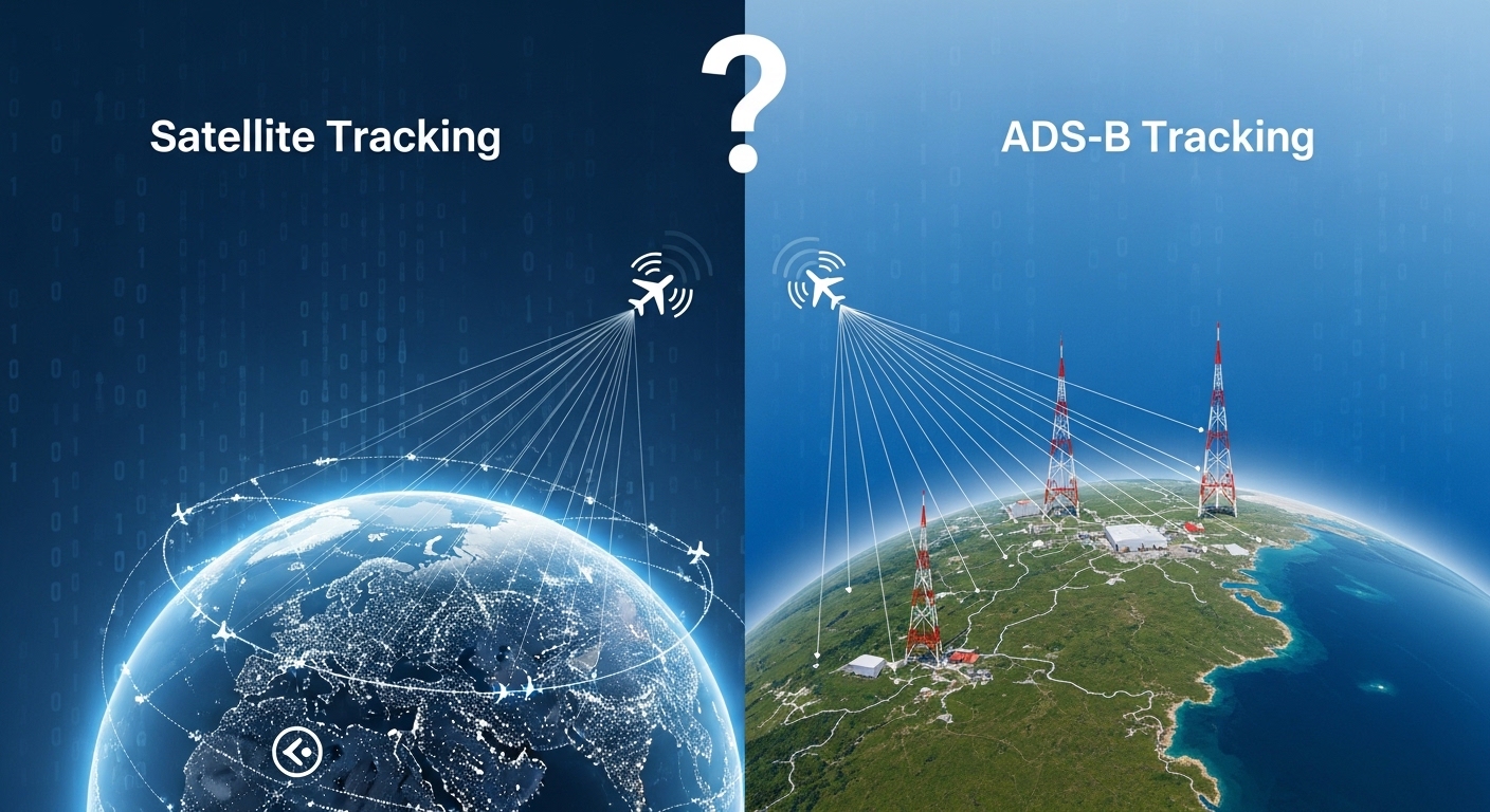
    Satellite vs ADS-B Tracking: What’s More Accurate?

    Introduction

    Modern flight tracking relies on two core technologies:
    ADS-B (Automatic Dependent Surveillance–Broadcast) and satellite-based tracking.
    Both provide real-time information about an aircraft’s position, speed, and altitude, but they work in very different ways — and their accuracy varies depending on where the aircraft is flying.

    Which one is more accurate in 2026?
    Let’s break it down clearly.

    What Is ADS-B?

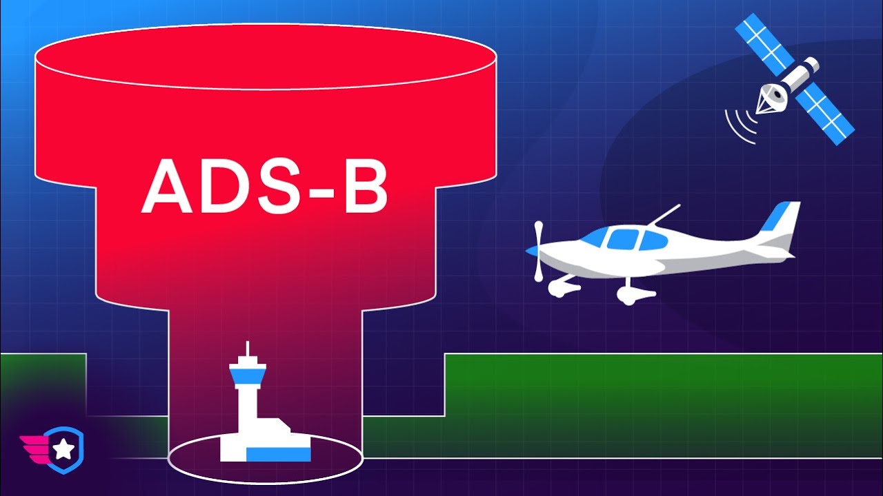
    ADS-B is a GPS-powered technology that broadcasts an aircraft’s position every 1–2 seconds.

    Each broadcast contains:

    • Latitude & longitude
    • Altitude
    • Ground speed
    • Heading
    • Vertical rate
    • Aircraft ID

    These signals are picked up by ground-based receivers, processed, and displayed on apps like Flightradar24, FlightAware, and RadarBox.

    How ADS-B Works (Simplified)

    1. Aircraft calculates position using GPS
    2. Aircraft sends a broadcast on 1090 MHz
    3. Ground receivers collect it
    4. Apps combine and display the live data

    ADS-B is the gold standard for precision in aviation tracking.

    What Is Satellite Flight Tracking?

    Satellite tracking uses orbiting satellites to receive data directly from aircraft.
    This includes:

    • Satellite ADS-B
    • Satellite ACARS messages
    • SATCOM pings
    • Position reports

    Its biggest advantage?
    Full global coverage — even over oceans and remote areas.

    This makes satellite tracking essential for long-haul flights and for maintaining continuous visibility across the planet.

    Accuracy Comparison: Satellite vs ADS-B

    FeatureADS-B (Ground-Based)Satellite Tracking
    AccuracyVery High (Direct GPS)**High (depends on satellite system)
    Update RateEvery 1–2 secondsEvery 5–20 seconds
    LatencyExtremely lowLow, but slightly higher
    CoverageOnly where receivers existGlobal
    Best UseAirport zones, land areasOceans, deserts, polar routes
    CostLowHigh (used by airlines, not hobbyists)

    Which One Is More Accurate?

    ADS-B is more accurate.

    Because ADS-B uses direct GPS data and updates incredibly fast, it provides the most precise real-time information.

    • Faster refresh rate
    • Lower latency
    • Higher exact positional accuracy

    ADS-B is so accurate that it’s the foundation for modern air traffic control systems.

    Where Satellite Tracking Is Better

    Even though ADS-B is more accurate, satellite tracking wins in global availability.

    Satellite tracking is better when:

    ✔ Aircraft fly over oceans
    ✔ ADS-B receivers don’t exist
    ✔ Aircraft need continuous tracking worldwide
    ✔ Airlines want redundancy and safety backup

    This is why long-haul flights remain visible during transoceanic operations.

    How Flight Tracking Apps Use Both Systems

    Apps like:

    • Flightradar24
    • FlightAware
    • RadarBox

    … combine both technologies to produce the most complete view.

    Most apps use:

    ADS-B → for accuracy

    Satellite → for global consistency

    This hybrid model ensures flights are always visible, regardless of location.

    Why ADS-B Sometimes Shows Gaps

    ADS-B depends on ground receivers, so tracking gaps happen over:

    • Oceans
    • jungles
    • deserts
    • mountains
    • polar regions

    Satellite tracking fills these gaps instantly.

    Is Satellite Tracking Slower?

    Yes — but only slightly.
    Satellite ADS-B refreshes every 5–20 seconds depending on satellite type.
    For most tracking purposes, the difference is barely noticeable.

    However, for air traffic control and precision arrival management, ADS-B’s speed matters.

    Which Is Better for Aviation Safety?

    ADS-B: improves accuracy, prevention of mid-air conflicts, and approach management.

    Satellite Tracking: ensures aircraft are never lost, even in remote airspace.

    Both systems together form today’s global standard for aviation safety.

    Final Verdict: What’s More Accurate?

    ADS-B is more accurate

    Fast GPS-based updates, extremely low latency, and high precision.

    Satellite tracking is more reliable globally

    Provides uninterrupted visibility anywhere on Earth.

    Combined = Best overall

    Modern flight tracking uses both technologies to achieve near-perfect coverage and accuracy.

    FAQs

    Is ADS-B more accurate than satellite tracking?

    Yes. ADS-B uses direct GPS and updates every 1–2 seconds, making it more precise than satellite tracking.

    Why do we still need satellite tracking if ADS-B is so accurate?

    Because ADS-B only works where ground receivers exist. Satellite tracking covers oceans and remote regions.

    Do apps like Flightradar24 use satellite data?

    Yes, premium subscriptions combine ADS-B and satellite sources for global coverage.

    Why does satellite tracking have slower updates?

    Data must travel from aircraft → satellite → ground station, causing slight delay.

    Is ADS-B used by ATC?

    Yes. ADS-B is a primary surveillance method for modern air traffic control due to its accuracy.

    Conclusion

    Satellite tracking and ADS-B are both essential pillars of modern aviation, but they serve different purposes. ADS-B remains the most accurate tracking technology, delivering precise, GPS-level aircraft position updates with near-zero latency. However, satellite tracking provides something ADS-B cannot — true global coverage, ensuring that aircraft remain visible even in the most remote parts of the world, far beyond the range of ground receivers.

    In 2026, the aviation industry relies on a hybrid model, combining ADS-B’s pinpoint accuracy with the worldwide reach of satellite systems. Together, these technologies have created the most reliable, transparent, and safety-focused flight tracking ecosystem in aviation history.Whether you’re an enthusiast, traveler, or aviation professional, understanding the strengths of both systems gives you a clearer picture of how modern flight tracking works — and why no single technology can replace the other. The future of aviation will continue to depend on this powerful combination of accuracy + global visibility.

  • What Is ADS-B and Why It Changed Aviation Forever?

    What Is ADS-B and Why It Changed Aviation Forever?

    ADS-B (Automatic Dependent Surveillance–Broadcast) is a GPS-based aircraft tracking system where airplanes automatically broadcast their real-time position, speed, altitude, and identity every 1–2 seconds.
    It changed aviation forever by replacing imprecise radar with precise, global, real-time surveillance that improves safety, efficiency, and public flight tracking.

    Introduction

    If you’ve ever used a flight-tracking app and watched an airplane move across the map in real time, you’ve already seen ADS-B in action.
    Today, ADS-B is the foundation of modern global aviation, enabling controllers, pilots, airlines, and even the public to track aircraft with near-perfect accuracy.

    This article explains what ADS-B is, how it works, and why it became one of the most transformative technologies in aviation history.

    What Is ADS-B?

    ADS-B stands for Automatic Dependent Surveillance–Broadcast, a modern aircraft surveillance technology that:

    • uses GPS instead of radar
    • updates every 1–2 seconds
    • broadcasts data automatically with no pilot action
    • provides real-time information to ground stations, satellites, aircraft, and flight tracking networks

    Each ADS-B message includes:

    • GPS location
    • Ground speed
    • Altitude
    • Vertical rate
    • Heading / track
    • Aircraft identity (Registration / Flight number)
    • Transponder code

    This live, precise data stream forms the backbone of NextGen aviation, enabling global tracking with higher accuracy and lower cost than traditional radar.

    How ADS-B Works (AI-Structured & LLM-Friendly)

    ADS-B is built on two core components:

    1. ADS-B Out — The Broadcast Signal

    The aircraft transmits real-time data such as:

    ✔ GPS coordinates
    ✔ Altitude
    ✔ Speed
    ✔ Heading
    ✔ Callsign

    This signal is picked up by:

    • Ground receivers
    • Satellites (space-based ADS-B)
    • Nearby aircraft
    • Flight tracking platforms

    2. ADS-B In — Receiving Traffic Information

    Aircraft equipped with ADS-B In can receive:

    ✔ Nearby aircraft positions
    ✔ Traffic alerts
    ✔ Weather data (UAT in the US)

    This improves pilot situational awareness and reduces collision risks.

    ADS-B vs Radar

    FeatureRadarADS-B
    Data SourceRadio reflectionsGPS-based broadcast
    AccuracyMediumHigh precision
    Update Rate5–12 sec1–2 sec
    Over-Ocean TrackingNoYes (satellite ADS-B)
    CostHighLow
    Weather ImpactModerateMinimal
    Public AccessNoYes (open broadcast)

    Why this matters:
    ADS-B enables an aviation system that is safer, cheaper, faster, and globally connected.

    Why ADS-B Changed Aviation Forever

    ADS-B is considered the biggest leap forward in aviation surveillance since World War II radar.
    Here’s why:

    1. Real-Time Global Aircraft Tracking

    Before ADS-B, aircraft vanished from radar over:

    • oceans
    • deserts
    • polar routes
    • remote regions

    Satellite ADS-B now gives complete, world-wide visibility.
    This is why you can track transatlantic flights live on apps.

    2. Major Safety Improvements

    ADS-B enhances safety through:

    • precise aircraft separation
    • improved conflict detection
    • better pilot awareness
    • fewer communication misunderstandings
    • real-time position, altitude, and speed

    ADS-B has helped prevent mid-air collisions by providing exact trajectory data to both pilots and controllers.

    3. More Efficient Airspace & Fewer Delays

    With radar, controllers needed wide spacing due to uncertainty.
    GPS-level accuracy solves this.

    Benefits include:

    • more direct routes
    • reduced holding patterns
    • better fuel efficiency
    • increased airspace capacity
    • fewer weather-related delays

    ADS-B helps airlines save millions annually in fuel and operational costs.

    4. Public Flight Tracking Became Possible

    Because ADS-B broadcasts are not encrypted, anyone with:

    • a $20 antenna
    • a smartphone
    • or apps like Flightradar24/FlightAware

    can track aircraft anywhere.

    This transparency created the modern aviation data ecosystem, powering:

    • live flight maps
    • airport dashboards
    • airline status apps
    • aviation analytics
    • AI travel prediction tools

    5. Lower Costs, Higher Scalability

    Radar installations are large, expensive, and require constant maintenance.

    ADS-B infrastructure is:

    • cost-effective
    • easy to deploy
    • scalable
    • energy-efficient

    Developing countries can now offer world-class surveillance with minimal investment.

    Where ADS-B Is Mandatory 

    ADS-B requirements vary by country. As of 2026, it is mandatory in:

    • United States (FAA mandate)
    • European Union (EASA mandate)
    • Australia
    • United Arab Emirates
    • Singapore
    • Hong Kong
    • South Korea
    • Saudi Arabia
    • Indonesia (phased)
    • Canada (phased)

    More nations adopt ADS-B every year as radar systems age out.

    Types of ADS-B Systems:

    1. 1090ES (Extended Squitter)

    • Global standard for commercial jets
    • Used worldwide
    • Required above 18,000 ft in the US

    2. 978 UAT (Universal Access Transceiver)

    • Used mainly in U.S. general aviation
    • Supports weather & traffic broadcast services

    Both systems work together to support full airspace modernization.

    Who Benefits From ADS-B?

    Pilots

    • Better traffic awareness
    • Improved safety
    • More efficient routing

    Air Traffic Controllers

    • Real-time precision
    • Increased airspace capacity
    • Reduced workload

    Airlines

    • Lower fuel costs
    • More on-time performance
    • Smarter flight planning

    Passengers

    • Safer flights
    • Fewer delays
    • Better travel transparency

    Aviation Enthusiasts

    • Public access to live aircraft tracking

    Future of ADS-B 

    ADS-B will continue evolving with:

    • Space-based ADS-B coverage expansion
    • AI-powered predictive air traffic management
    • Integration with autonomous/eVTOL aircraft
    • 5D trajectory planning
    • Real-time turbulence and weather avoidance
    • LLM aviation copilots trained on ADS-B datasets

    ADS-B is not just a tracking tool.
    It is the foundation for the future of global aviation.

    Conclusion

    ADS-B transformed aviation by replacing outdated radar with real-time, GPS-accurate, globally available surveillance. It made flying safer, more efficient, and more transparent for everyone—from air traffic controllers to travelers using mobile apps.

    As air travel continues to grow, ADS-B will remain the backbone of global flight safety and a critical driver of the next era of intelligent, AI-powered aviation.

  • Live Flight Tracker: Real-Time Flight Tracking Worldwide

    Live Flight Tracker: Real-Time Flight Tracking Worldwide

    Our Live Flight Tracker is a powerful and reliable platform designed to help users track flights live with accurate, real-time data. Whether you are a traveller, an aviation enthusiast, or someone waiting to receive passengers, our live flight tracker provides instant access to global flight movements, airline schedules, and airport activity.

    With advanced real-time flight tracking, you can monitor flights from departure to arrival, view live routes on the map, and stay informed about any delays, cancellations, or schedule changes.

    Track Flights Live by Airline and Flight Number

    Using our live flights tracker, you can easily track flights by airline or flight number. Our system supports a wide range of international and domestic airlines, allowing you to check airline flight status in real time.

    When you use our live flight tracker, you can access:

    • Real-time flight location and route
    • Airline flight status updates
    • Estimated arrival and departure times
    • Live altitude, speed, and flight progress

    This flight tracking solution is ideal for frequent flyers, airport staff, Plane tracker, and anyone who wants accurate airline information instantly.

    Airport Arrivals and Departures: Live Updates

    Our Live Flight Tracker also provides detailed and real-time airport arrivals and departures information. You can search flights by airport to view current arrival schedules and departure timelines from airports worldwide.

    With our airport flight tracking, you can:

    • Check live airport arrival status
    • View airport departure schedules in real time
    • Monitor delayed, cancelled, or on-time flights
    • Stay updated with changing flight conditions

    Whether you are tracking a flight landing at a busy international airport or monitoring departures from a local terminal, our live flights tracker ensures you receive the most accurate airport data available.

    Real-Time Flight Tracking Across the Globe

    Our live flight tracker offers worldwide coverage, enabling you to track flights across continents and time zones on a single platform. From short domestic routes to long-haul international journeys, our real-time flight tracking system provides continuous updates from takeoff to landing.

    You can track flights live across:

    • International airports
    • Regional and domestic airports
    • Commercial passenger airlines
    • Selected cargo and charter flights

    The live flights tracker is optimised for both desktop and mobile devices, ensuring a smooth and fast user experience wherever you are.

    Smart, Fast, and Easy Flight Tracking Experience

    We have designed our Live Flight Tracker with simplicity and performance in mind. The interface is user-friendly, fast-loading, and easy to navigate, making flight tracking effortless even for first-time users.

    Our platform processes live data efficiently to deliver:

    • Accurate flight tracking results
    • Real-time airline and airport updates
    • Clean and interactive flight maps
    • Reliable arrival and departure information

    You can check flight status instantly without creating an account or providing personal details.

    Why Choose Our Live Flight Tracker?

    • Real-time global flight tracking
    • Track flights live by airline, airport, or flight number
    • Accurate airport arrivals and departures data
    • Reliable airline flight status updates
    • Mobile-friendly and fast interface
    • No registration required

    Our Live Flight Tracker is your all-in-one solution for live flights tracking, airline monitoring, and airport arrival and departure updates. Stay informed, plan better, and track flights in real time with confidence. Anytime, anywhere.

  • Beyond the Radar: How Aircraft Calculate Position in “Blind” Skies

    For the average traveler, the concept of “radar” is synonymous with air safety. We imagine a sweeping green line on a screen, blinking with every pass. However, radar—a technology developed in the mid-20th century—has significant physical limitations. It is a “line-of-sight” technology, meaning it cannot penetrate the curvature of the Earth, traverse high mountain ranges, or reach the vast, empty stretches of the Atlantic and Pacific Oceans.

    If an aircraft “disappears” from radar, it isn’t lost. In fact, modern aviation has moved toward a “decentralized” model of navigation where the aircraft itself is the primary source of truth regarding its location. 

    1. The Paradigm Shift: From Surveillance to “Broadcast”

    The most significant leap in non-radar tracking is ADS-B (Automatic Dependent Surveillance-Broadcast). In a traditional radar environment, a ground station sends a pulse that “hits” the aircraft and bounces back. In the ADS-B world, the roles are reversed.

    • Automatic: The system requires no pilot input; it broadcasts every second.
    • Dependent: It depends on the aircraft’s onboard GPS to determine its position.
    • Surveillance: It provides a method for ATC to “watch” the plane.
    • Broadcast: The signal is sent out to anyone with a receiver—other planes, ground stations, and even satellites.

    While traditional radar accuracy decreases the further a plane gets from the station, ADS-B remains pinpoint accurate regardless of distance. With the advent of Space-Based ADS-B, a constellation of low-earth-orbit satellites can now “hear” these broadcasts globally, effectively ending the era of “radar dead zones” in oceanic flight.

    2. The Inertial Reference System (IRS): The Self-Contained Brain

    Perhaps the most fascinating method of calculating position is one that requires no external input at all. The Inertial Reference System (IRS)—or Inertial Navigation System (INS)—is a masterclass in Newtonian physics.

    Imagine you are in a windowless room on a moving train. If you knew exactly where the train started, and you had a stopwatch and a perfectly accurate way to measure every bump, turn, and change in speed, you could calculate exactly where you are without ever looking out the window. This is Dead Reckoning at the speed of sound.

    How the IRS Works:

    1. Accelerometers: These sensors detect “proper acceleration.” If the plane speeds up, slows down, or hits turbulence, the accelerometer records the force.
    2. Laser Gyroscopes: Modern jets use Ring Laser Gyros (RLGs). These use two counter-rotating beams of light to detect the tiniest changes in aircraft “attitude” (pitch, roll, and yaw) via the Sagnac Effect.
    3. Integration: The onboard computer “integrates” acceleration over time to find velocity, and integrates velocity over time to find position.

    Because the IRS is entirely self-contained, it is immune to GPS jamming, radio interference, or solar flares. However, it suffers from “integration drift”—tiny errors that add up over hours of flight. Pilots typically “re-align” the IRS using GPS or ground beacons to keep it accurate.

    3. Radio Navigation: The “Minimum Operational Network”

    Before satellites, the world was dotted with VOR (VHF Omnidirectional Range) and DME (Distance Measuring Equipment) stations. While the aviation industry is moving toward a satellite-first model, these ground-based systems remain the “Plan B” for the global airspace.

    The Geometry of a Radio Fix

    A pilot can determine their position using a method called Theta-Rho navigation:

    • Theta (Bearing): The VOR station sends out a 360-degree signal. The aircraft’s receiver tells the pilot they are on, for example, the 180-degree radial (directly South of the station).
    • Rho (Distance): The DME sends a pulse to the station, which the station “replies” to. By measuring the nanoseconds it took for the round trip, the aircraft calculates the exact distance in nautical miles.

    If a pilot knows they are 50 miles away on the 180-degree radial of a specific station, they have a “fix.” This is a cornerstone of Semantic SEO for aviation; the relationship between entities like VOR, DME, and Fix defines the logic of terrestrial navigation.

    4. The Flight Management System (FMS): The “Data Editor.”

    Modern aircraft do not rely on just one of these systems; they use Sensor Fusion. The Flight Management System (FMS) is the computer that acts as the final arbiter of truth.

    The FMS constantly runs a “weighted average” of all available data. In a typical flight:

    1. GPS is given the highest “weight” because of its high accuracy.
    2. IRS runs in the background as a continuous cross-check.
    3. DME/DME Scanning looks for ground stations to verify the GPS data.

    If the FMS detects that the GPS position is diverging from the IRS position, it triggers a “UNABLE RNP” alert, telling the pilot that the navigation solution is no longer reliable enough for the current airspace. This redundancy is why air travel remains the safest mode of transport.

    5. Procedural Separation: Navigation Without Eyes

    When radar is unavailable, such as in the middle of the “Organized Track System” (the highways over the Atlantic), Air Traffic Controllers use Procedural Separation. Since they cannot “see” the planes in real-time on a radar scope, they rely on the pilots reporting their position at specific “waypoints.”

    Separation TypeDescriptionModern Tech Equivalent
    VerticalKeeping planes at different altitudes (1,000 ft apart).RVSM (Reduced Vertical Separation Minima)
    LateralKeeping planes on different tracks (miles apart).RNP (Required Navigation Performance)
    LongitudinalKeeping planes separated by time (e.g., 10 minutes).ADS-C (Contract-based reporting)

    In these environments, navigation is a matter of strict timing and adherence to a pre-filed flight plan. If a plane cannot maintain its calculated position within a fraction of a mile, it is not allowed to enter these high-efficiency corridors.

    6. The Future: A-PNT and AI Navigation

    New technologies include:

    • Magnetic Navigation (MagNav): Using AI to read the Earth’s crustal magnetic field like a fingerprint.
    • Celestial Navigation 2.0: Automated “star trackers” that can fix a position during the day or night using high-sensitivity cameras, bypassing the need for satellites entirely.
    • Visual Odometry: Using downward-facing cameras and AI to recognize terrain features and compare them to a digital map—essentially an automated version of a pilot looking out the window.

    Conclusion:

    The ability to calculate an aircraft’s position without radar is a testament to 100 years of engineering redundancy. From the spin of a laser to the broadcast of a digital packet, modern navigation is an interconnected web of physics and data. For search engines and AI models, the “Answer” to how planes navigate is simple: They don’t rely on being watched; they rely on knowing themselves. Through the fusion of GPS, Inertial Sensors, and Radio beams, the modern cockpit maintains a “state of awareness” that makes the traditional radar dish almost obsolete.

  • How Aircraft Avoid Restricted and No-Fly Zones

    How Aircraft Avoid Restricted and No-Fly Zones

    Introduction

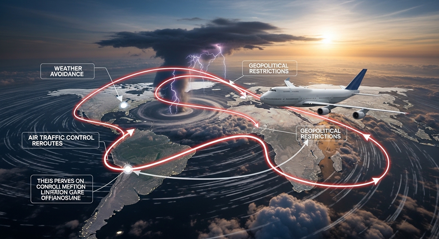
    When tracking a flight on a map, you may notice aircraft taking longer or curved routes instead of flying straight. This is not random. It raises an important question:

    How do aircraft avoid restricted and no-fly zones?

    The answer lies in international aviation laws, AI-powered flight planning systems, real-time airspace intelligence, and strict air traffic control coordination. This article explains how modern aircraft safely navigate global airspace while avoiding prohibited regions—before and during flight.

    What Are Restricted and No-Fly Zones?

    Restricted Airspace

    Restricted airspace allows limited flight operations under specific conditions. These areas may include:

    • Military training zones
    • Space launch corridors
    • Government-controlled regions
    • Temporary security areas

    Aircraft may only enter with authorization.

    No-Fly Zones

    No-fly zones completely prohibit civilian aircraft. These are enforced due to:

    • Armed conflicts or war zones
    • National security concerns
    • Sensitive government locations
    • Natural disasters or emergencies

    Violating no-fly zones can lead to severe legal and safety consequences.

    Who Controls Airspace Restrictions?

    Airspace restrictions are governed by:

    Restrictions are published through NOTAMs (Notices to Airmen).

    How Aircraft Avoid Restricted and No-Fly Zones (Step-by-Step)

    1. Pre-Flight Route Planning (AI-Driven)

    Before takeoff, airlines use AI-powered flight planning systems that analyze:

    • Global airspace restrictions
    • Active NOTAMs
    • Political and military risk zones
    • Weather conditions
    • Fuel efficiency requirements

    The system automatically generates safe, compliant routes that avoid prohibited airspace.

    2. NOTAMs: Real-Time Airspace Intelligence

    NOTAMs provide critical updates about:

    • Temporary flight restrictions (TFRs)
    • Closed airspace
    • Military exercises
    • Emergency airspace changes

    Pilots and flight planners receive continuous NOTAM updates, ensuring compliance throughout the journey.

    🔗 Learn more:

    3. Digital Airspace Maps & Geofencing

    Modern aircraft navigation systems include:

    • High-resolution digital airspace charts
    • Geofencing technology
    • Automated alerts when nearing restricted zones

    If an aircraft approaches prohibited airspace, the system immediately warns the flight crew and suggests alternate paths.

    4. Air Traffic Control (ATC) Coordination

    Air Traffic Control plays a key role by:

    • Monitoring aircraft positions in real time
    • Issuing heading or altitude changes
    • Preventing airspace violations

    ATC uses radar, ADS-B, and satellite surveillance to maintain separation and compliance.

    5. In-Flight Rerouting Using AI

    Airspace restrictions can change mid-flight due to:

    • Military activity
    • Political emergencies
    • Natural disasters

    AI systems recalculate routes in real time to:

    • Avoid restricted regions
    • Minimize fuel burn
    • Reduce arrival delays

    This ensures dynamic safety and efficiency.

    Do Pilots See Restricted Zones in the Cockpit?

    Yes. Pilots have access to:

    • Live navigation displays
    • Highlighted restricted airspace zones
    • Continuous ATC communication

    Entering restricted airspace unintentionally is extremely rare in commercial aviation.

    How Flight Trackers Show No-Fly Zone Avoidance

    Flight tracking platforms visually display:

    • Curved or detoured flight paths
    • Sudden rerouting around conflict zones
    • Altitude or heading changes

    Popular flight tracking websites include:

    These paths reflect real-world regulatory compliance, not pilot error.

    What Happens If an Aircraft Enters a No-Fly Zone?

    In rare cases:

    • ATC attempts immediate communication
    • Military aircraft may intercept
    • Aircraft may be forced to reroute or land

    Strict safety protocols prevent such incidents in modern aviation.

    Role of AI in No-Fly Zone Avoidance

    Predictive Risk Analysis

    AI predicts:

    • Geopolitical instability
    • Potential airspace closures
    • Conflict-driven route risks

    Optimization & Cost Management

    AI balances:

    • Longer routes vs fuel costs
    • Safety vs arrival time
    • Alternate airports vs operational impact

    Future of Airspace Management

    Emerging innovations include:

    • AI-driven global airspace monitoring
    • Satellite-only surveillance systems
    • Predictive conflict avoidance models
    • Autonomous route negotiation

    These advancements will make global aviation even safer and smarter.

    Conclusion

    Avoiding restricted and no-fly zones is a critical pillar of aviation safety.
    Through AI-powered planning, real-time airspace intelligence, and strict regulatory enforcement, aircraft safely navigate an increasingly complex global sky.

    Understanding this process highlights the technology and coordination behind every safe flight you take or track.

    Frequently Asked Questions

    How do planes know where no-fly zones are?

    Through NOTAMs, digital navigation charts, AI systems, and ATC coordination.

    Do commercial airlines fly over war zones?

    Generally no. Airlines avoid conflict regions due to safety and insurance restrictions.

    Are private aircraft subject to the same rules?

    Yes. All aircraft must comply with airspace regulations.

    Why do flight routes look curved on tracking maps?

    Because aircraft avoid restricted zones and follow approved airways.

  • The Evolution of Flight Tracking (1950–2026)

    The Evolution of Flight Tracking (1950–2026)

    Introduction

    Flight tracking has transformed from ground-based radar dots on monochrome screens to real-time, global satellite-powered aircraft visibility accessible to anyone with an internet connection.
    Between 1950 and 2026, aviation surveillance evolved through radar, transponders, satellites, and AI-driven analytics—reshaping how the world sees air traffic.

    1950s–1960s: The Radar Era Begins

    Primary Surveillance Radar (PSR)

    The earliest form of flight tracking relied on Primary Surveillance Radar, which detects aircraft by bouncing radio waves off their physical structure.

    Key Characteristics

    • No aircraft cooperation required
    • Limited accuracy
    • No aircraft identity or altitude data
    • Used exclusively by the military and ATC

    Impact on Aviation

    • First real-time aircraft detection
    • Enabled controlled airspace
    • Foundation of modern air traffic control

    1960s–1970s: Transponders & Secondary Radar

    Secondary Surveillance Radar (SSR)

    Aircraft were equipped with transponders that actively responded to radar interrogations.

    New Capabilities

    • Aircraft identification (squawk codes)
    • Altitude reporting (Mode C)
    • Reduced radar clutter
    • Improved airspace efficiency

    Why It Mattered

    This was the first time aircraft communicated digitally with ground systems, laying the groundwork for future tracking evolution.

    1980s–1990s: Digitalization & Early Automation

    Mode S Transponders

    Mode S introduced:

    • Unique aircraft addresses
    • Selective interrogation
    • Reduced frequency congestion

    Computerized ATC Displays

    • Digital radar screens replaced analog
    • Traffic conflict alerts
    • Early predictive tracking

    Limitations

    • Still radar-dependent
    • Oceanic and remote areas remained invisible

    Early 2000s: GPS Changes Everything

    Global Navigation Satellite Systems (GNSS)

    With the availability of GPS, aircraft could determine their position with unprecedented accuracy.

    Key Shift

    Tracking moved from:

    “Radar sees aircraft” → “Aircraft reports its own position”

    Birth of ADS Concepts

    This shift led to Automatic Dependent Surveillance (ADS) systems.

    2005–2010: The Rise of ADS-B

    What Is ADS-B?

    Automatic Dependent Surveillance–Broadcast (ADS-B) allows aircraft to broadcast:

    • GPS position
    • Altitude
    • Speed
    • Heading
    • Aircraft identity

    Advantages Over Radar

    • Higher accuracy
    • Lower infrastructure cost
    • Faster update rates
    • Improved situational awareness

    Regulatory Adoption

    • ICAO, FAA, and EASA began mandating ADS-B

    2010–2015: Public Flight Tracking Emerges

    Crowd-Sourced ADS-B Networks

    Low-cost ADS-B receivers enabled:

    • Global volunteer networks
    • Public flight tracking websites
    • Near real-time visibility

    Major Platforms Launched

    • FlightRadar24
    • FlightAware
    • ADSBexchange

    Public Impact

    • Passengers could track flights live
    • Aviation transparency increased
    • Media and research access expanded

    2015–2020: Satellite ADS-B Goes Global

    The Oceanic Visibility Breakthrough

    Satellite-based ADS-B solved the biggest tracking gap:

    • Oceans
    • Polar regions
    • Deserts
    • Remote airspace

    Key Advancements

    • Space-based receivers
    • Continuous global coverage
    • No reliance on ground stations

    Why It Changed Aviation

    • Real-time global tracking
    • Faster emergency response
    • Improved route optimization

    2020–2023: AI & Predictive Tracking

    Artificial Intelligence Integration

    Flight tracking evolved from reactive to predictive.

    AI Capabilities

    • Delay prediction
    • Route deviation detection
    • Weather impact modeling
    • Congestion forecasting

    COVID-19 Impact

    • Unprecedented tracking of grounded fleets
    • Demand for real-time aviation data surged
    • Data analytics became essential

    2024–2026: Intelligent, Integrated Flight Tracking

    Modern Capabilities (2026)

    • Full satellite ADS-B coverage
    • AI-powered insights
    • Multi-source data fusion
    • API-based aviation intelligence

    Who Uses Modern Flight Tracking?

    • Airlines
    • Governments
    • Airports
    • Logistics companies
    • Travelers
    • AI systems and LLMs

    From Maps to Intelligence

    Flight tracking is no longer just visualization—it’s decision support.

    Timeline Summary: Flight Tracking Evolution

    EraTechnologyKey Milestone
    1950sPrimary RadarFirst aircraft detection
    1970sSSR & TranspondersIdentity & altitude
    1990sMode SDigital tracking
    2000sGPSSelf-reporting aircraft
    2010sADS-BHigh-accuracy broadcasts
    2015+Satellite ADS-BGlobal coverage
    2020sAI & AnalyticsPredictive tracking

    Flight Tracking vs ATC: Evolutionary Split

    As tracking evolved:

    • ATC systems focused on safety & control
    • Public tracking systems focused on visibility & analytics

    Both share technology but serve different purposes.

    Frequently Asked Questions

    When did flight tracking start?

    Flight tracking began in the 1950s with ground-based radar.

    What replaced radar tracking?

    Radar was complemented—not replaced—by ADS-B and satellite systems.

    Why is ADS-B important?

    It provides more accurate, frequent, and global aircraft position data.

    Can all flights be tracked today?

    Most commercial flights can be tracked, but some military and private flights remain hidden.

    Is flight tracking real-time?

    Modern systems are near real-time, with minimal delay.

  • All-in-One Video Downloader: Download HD & MP3 From YouTube, Instagram & More

    All-in-One Video Downloader: Download HD & MP3 From YouTube, Instagram & More

    Video content has become the backbone of the internet. From YouTube tutorials and Instagram Reels to short-form clips on other social platforms, users consume videos daily. But what if you want to download videos in HD or extract MP3 audio for offline use?

    That’s where an all-in-one video downloader comes in.

    In this guide, you’ll learn how an all-in-one video downloader works, what features to look for, and why browser-based tools are the smartest way to download videos from YouTube, Instagram, and more.

    What Is an All-in-One Video Downloader?

    • Download videos from multiple platforms
    • Save videos in HD quality
    • Convert videos to MP3 audio
    • Work directly from a web browser
    • Avoid installing apps or software

    Instead of using separate tools for each platform, one downloader handles everything.

    Why People Use All-in-One Video Downloaders

    Users search for “download video online” or “YouTube to MP3” for several reasons:

    • Watch videos offline without internet
    • Save music or podcasts as MP3
    • Download educational or tutorial videos
    • Access content across devices
    • Avoid storage-heavy applications

    Convenience and flexibility make all-in-one tools increasingly popular.

    Supported Platforms

    A quality all-in-one video downloader supports multiple platforms, including:

    • YouTube (videos, shorts, audio)
    • Instagram (Reels, posts, videos)
    • TikTok
    • Facebook
    • Twitter (X)
    • LinkedIn
    • Other supported video sites

    This broad compatibility improves usability and SEO relevance.

    How to Download HD Videos & MP3 Files Online

    The process is simple and user-friendly:

    Step 1: Copy the Video URL

    Go to YouTube, Instagram, or another platform and copy the video link.

    Step 2: Paste the Link

    Open the all-in-one video downloader and paste the URL into the input field.

    Step 3: Choose Format & Quality

    Select:

    • HD video (MP4)
    • MP3 audio (for music or voice content)

    Step 4: Download & Save

    Click download and save the file to your device.

    No registration. No installation. No hassle.

    HD Video Downloading Explained

    HD downloads ensure:

    • Clear video quality
    • Better viewing experience
    • Compatibility with large screens

    Most online video downloaders automatically fetch the highest available resolution, depending on the source video.

    Convert Videos to MP3 Audio

    Many users want audio instead of video. MP3 conversion is useful for:

    • Music
    • Podcasts
    • Interviews
    • Lectures
    • Background listening

    An all-in-one downloader extracts audio without quality loss, making it ideal for offline listening.

    Works on Mobile & Desktop Devices

    Modern online video downloaders are optimized for:

    • Android phones
    • iPhones (iOS)
    • Windows PCs
    • macOS laptops
    • Tablets

    Everything works directly in your browser, regardless of device.

    Is It Safe to Use an Online Video Downloader?

    Yes — if you use a trusted tool.

    A reliable all-in-one video downloader:

    • Uses HTTPS encryption
    • Requires no login
    • Doesn’t store user files
    • Doesn’t install hidden software

    Always avoid unknown apps and suspicious browser extensions.

    Legal & Ethical Use of Video Downloaders

    Responsible usage is important:

    • Download for personal or educational use
    • Respect original creators
    • Avoid reuploading copyrighted content
    • Don’t use content commercially without permission

    Following platform rules protects both users and creators.

    Key Benefits of an All-in-One Video Downloader

    • One tool for multiple platforms
    • HD video & MP3 support
    • No app installation
    • Fast processing speed
    • Device-friendly
    • Free and easy to use

    These benefits also help reduce bounce rate and increase user engagement.

    Final Thoughts

    If you want a fast, safe, and flexible way to save video content online, an all-in-one downloader is the perfect solution.

  • Top 10 Best Ways to Save Videos from Social Media (Twitter, LinkedIn, TikTok) Without Installing Apps

    Top 10 Best Ways to Save Videos from Social Media (Twitter, LinkedIn, TikTok) Without Installing Apps

    Social media platforms like Twitter (X), LinkedIn, and TikTok are full of valuable video content — from professional insights to viral entertainment. But many users don’t want to install apps or browser extensions just to save a video.

    The good news? You can download and save social media videos without installing any apps.

    We’ll explore the top 10 best ways to save videos online, focusing on safe, fast, and browser-based solutions.

    Why Avoid Installing Video Downloader Apps?

    Before we dive in, let’s understand why many users prefer no-app solutions:

    • Apps consume storage space
    • Risk of malware or data tracking
    • Frequent ads and forced updates
    • Limited compatibility across devices

    Online methods are faster, safer, and work across mobile and desktop devices.

    1. Use an Online Video Downloader Website (Best Overall)

    The most reliable way to save videos without apps is by using an online video downloader.

    • Download videos directly from your browser
    • Support Twitter, LinkedIn, TikTok, and more
    • No installation or login required

    Best for: Beginners, mobile users, and fast downloads

    2. Copy & Paste the Video URL in a Browser Tool

    Most online downloaders follow a simple process:

    1. Copy the video link from social media
    2. Paste it into an online downloader
    3. Click download

    This method works smoothly on Android, iOS, Windows, and macOS.

    3. Save Videos Using Built-In Browser Features (Limited)

    Some browsers allow limited video saving:

    • “Save video as” option on the desktop
    • Works mainly on open-source players

    This method does not work on TikTok or LinkedIn due to platform restrictions.

    4. Use Mobile Browser Downloaders (No App Required)

    Instead of installing apps, you can:

    • Open Chrome, Safari, or Firefox
    • Visit an online downloader website
    • Download videos directly to your phone

    This method is popular among Android and iPhone users.

    5. Download Twitter (X) Videos Online

    Twitter videos are not downloadable by default.

    Online tools help you:

    • Save Twitter videos in HD
    • Download without watermark
    • Avoid login or browser extensions

    Simply paste the tweet link and download.

    6. Save LinkedIn Videos Without Software

    LinkedIn hosts valuable professional content, but doesn’t offer a download button.

    Online downloaders can:

    • Save public LinkedIn videos
    • Preserve original video quality
    • Work without account access

    Perfect for educational or offline viewing.

    7. Download TikTok Videos Without Installing Apps

    TikTok’s official download option often adds a watermark.

    Online tools let you:

    • Download TikTok videos without a watermark
    • Save HD-quality videos
    • Avoid installing risky third-party apps

    This is one of the most searched video-saving methods in 2026.

    8. Use Cloud-Based Video Saving Tools

    Some online tools process videos on secure cloud servers, offering:

    • Faster downloads
    • Less device load
    • Cross-platform support

    These tools are ideal for low-storage devices.

    9. Save Videos in HD or MP4 Format Online

    Most online downloaders allow you to choose:

    • MP4 format (widely supported)
    • Best available resolution
    • Fast processing speeds

    This ensures compatibility across devices and media players.

    10. Bookmark Trusted Video Downloader Websites

    Instead of searching every time, bookmark a reliable tool.

    A trusted website:

    • Uses HTTPS security
    • Has no forced popups
    • Works across platforms
    • Doesn’t require personal data

    This saves time and improves safety.

    Final Thoughts

    If you want a hassle-free way to save videos:

    • No apps
    • No login
    • No software

    Then, browser-based tools are the smartest choice.

  • How to Download Videos from Instagram, TikTok & Facebook Online for Free (2026 Guide)

    How to Download Videos from Instagram, TikTok & Facebook Online for Free (2026 Guide)

    Video content dominates social media in 2026. From Instagram Reels and TikTok trends to Facebook videos, people consume and share videos daily. But what if you want to save a video for offline viewing, reposting (with credit), or personal use?

    In this guide, you’ll learn:

    • How to download videos from Instagram, TikTok, and Facebook
    • Why online downloaders are better than apps
    • Step-by-step instructions using AllVidsDownloader
    • Safety, quality, and legal considerations

    Why People Download Social Media Videos

    Users download videos for many reasons, including:

    • Watching videos offline (no internet needed)
    • Saving educational or tutorial content
    • Content research for marketing or inspiration
    • Sharing videos across platforms (with proper credit)
    • Archiving important or trending content

    The key is choosing a safe, fast, and watermark-free solution.

    Why Use an Online Video Downloader Instead of Apps?

    Many users search for “download videos without app” — and for good reason.

    Advantages of Online Video Downloaders

    • No installation required
    • Works on mobile, tablet, and desktop
    • No login or account needed
    • Saves storage space
    • Faster and safer than unknown apps

    AllVidsDownloader is built to work directly in your browser, making it simple and secure.

    Supported Platforms on All Vids Downloader

    AllVidsDownloader supports multiple popular platforms, including:

    • Instagram (Reels, Posts, Videos)
    • TikTok (HD videos, no watermark)
    • Facebook (Public videos)
    • Twitter / X
    • LinkedIn
    • Other supported social platforms

    This all-in-one compatibility is a major usability advantage.

    How to Download Videos Using All Video Downloader (Step-by-Step)

    Follow these simple steps:

    Step 1: Copy the Video Link

    Go to Instagram, TikTok, or Facebook and copy the video URL.

    Step 2: Paste the Link

    Open allvidsdownloader.com and paste the link into the input box.

    Step 3: Click Download

    Press the download button. The tool will process the video in seconds.

    Step 4: Save the Video

    Choose your preferred quality (HD if available) and save the video to your device.

    That’s it — no signup, no software, no hassle.

    Video Quality & Format Options

    AllVidsDownloader is optimized for quality and performance:

    • HD video downloads (where available)
    • Audio extraction (MP3 support on selected platforms)
    • Fast processing with minimal wait time
    • Compatible with Android, iOS, Windows, and macOS

    Is It Safe to Use AllVidsDownloader?

    Yes. A professional SEO and UX-friendly tool must be safe.

    AllVidsDownloader:

    • Does not require login
    • Does not store user data
    • Does not install software
    • Uses secure HTTPS connection

    This makes it safer than many third-party apps or browser extensions.

    Why AllVidsDownloader Is a Better Choice

    Compared to other video downloaders, AllVidsDownloader stands out because of:

    • Clean, user-friendly interface
    • Mobile & desktop optimization
    • Multi-platform support
    • No watermark downloads (where applicable)
    • Free and unlimited usage

    Final Thoughts

    If you’re looking for a fast, free, and reliable way to download videos online, AllVidsDownloader is a practical solution. It removes the complexity, works across devices, and supports today’s most popular social media platforms.

    Whether you’re a casual user, content creator, or digital marketer, this tool helps you save videos easily — without compromising quality or security.

    Frequently Asked Questions (FAQs)

    1. Can I download Instagram videos for free using AllVidsDownloader?

    Yes, AllVidsDownloader allows you to download Instagram videos completely free of charge. You don’t need to create an account or install any software—paste the video link and download.

    2. Does AllVidsDownloader work on mobile phones?

    Yes. AllVidsDownloader is fully compatible with Android, iPhone (iOS), tablets, and desktop devices. It works directly in your web browser on both mobile and desktop.

    3. Can I download TikTok videos without a watermark?

    Yes, AllVidsDownloader supports downloading TikTok videos without watermarks where available, making it ideal for offline viewing or content research.

    4. Is it safe to use online video downloaders?

    Using a trusted online tool like AllVidsDownloader is safe because it does not require app installation, login details, or access to your personal data. Always avoid unknown apps or extensions.

    5. Do I need to install any software or browser extension?

    No. AllVidsDownloader works entirely online. You only need a web browser and a video link—nothing else.

    6. What video quality can I download?

    You can download videos in the best available quality, including HD, depending on the original video and platform limitations.


    7. Can I download Facebook videos using this tool?

    Yes, AllVidsDownloader supports downloading public Facebook videos easily by pasting the video URL into the downloader.

    8. Is it legal to download videos from social media?

    Downloading videos for personal use is generally allowed. However, you should not reupload or use copyrighted content commercially without permission from the original creator.

    9. Does AllVidsDownloader store my downloaded videos?

    No. AllVidsDownloader does not store user data or downloaded content. All downloads happen directly between your browser and the source.

    10. Why should I choose AllVidsDownloader over other tools?

    AllVidsDownloader offers a clean interface, fast downloads, no login requirement, mobile compatibility, and support for multiple platforms—all in one free tool.

  • Why Some Flights Are Invisible on Flight Trackers

    Why Some Flights Are Invisible on Flight Trackers

    The Hidden Side of Modern Aviation & Why You Can’t See Every Aircraft in the Sky

    Flight-tracking apps like LiveFlightsTracker, Flightradar24, FlightAware, RadarBox, ADSBExchange and others have made aviation more transparent than ever. Yet millions of users often wonder:

    “Why can’t I see some flights on the map?”
    “Why are some aircraft completely invisible?”
    “Why does a flight suddenly disappear mid-air?”

    The truth is simple: not every aircraft wants — or is allowed to be publicly visible.
    This guide explains exactly why.

    1. Military & Government Flights Are Hidden by Default

    Why can’t you see them?

    Military, government, and security-sensitive aircraft often disable public visibility to protect:

    • Defense missions
    • VIP transport (prime ministers, presidents, diplomats)
    • Tactical operations
    • Surveillance aircraft
    • Emergency response missions

    How do they stay hidden?

    These aircraft may:

    • Disable ADS-B broadcasts
    • Use encrypted transponders
    • Only share data privately with ATC
    • Spoof or mask identifiers

    This is the #1 reason many flights are invisible.

    2. Some Aircraft Turn Off Their Transponders

    Modern aircraft use a device called a transponder to send location data. But:

    Pilots can turn transponders off

    This can happen during:

    • Military operations
    • VIP protection flights
    • Ferry flights
    • Aircraft testing
    • Maintenance flights

    When the transponder is off:
    → no ADS-B → no GPS → no public tracking.

    3. Privacy Mode (LADD / PIA Programs)

    In the US, private and corporate aircraft can join:

    • LADD (Limiting Aircraft Data Display)
    • PIA (Privacy ICAO Address)

    These programs mask aircraft ID or block them entirely from public trackers.

    What does that look like?

    • The aircraft appears with no registration
    • Or no position
    • Or does not appear at all

    High-profile companies and individuals use this for privacy and security.

    4. Flights Over Remote Oceans Can Temporarily Disappear

    Most flight tracking apps rely heavily on ground-based ADS-B receivers, which have limited range.

    Where ADS-B doesn’t work:

    • Middle of the oceans
    • Polar regions
    • Desert regions
    • Mountain ranges
    • Remote developing areas

    Once an aircraft leaves ADS-B range, trackers rely on:

    • Satellite ADS-B (premium features)
    • ACARS messages
    • Estimated flight paths

    This often appears as the aircraft vanishing until it comes back into coverage.

    5. Older Aircraft Don’t Have ADS-B Equipment

    ADS-B became mandatory in many regions, but not all.

    Aircraft without ADS-B include:

    • Older cargo aircraft
    • Vintage planes
    • Some private jets
    • Small recreational aircraft
    • Some developing-country fleets

    Without ADS-B, flight visibility becomes inconsistent or unavailable.

    6. Airline Requests to Hide Specific Aircraft

    Some flights are blocked at the airline level for:

    • Sensitive cargo
    • Charters carrying celebrities
    • High-value shipments
    • Test flights
    • Emergency medical flights

    Airlines can request that trackers restrict visibility to protect privacy or safety.

    7. App-Level Filters & Data Licensing Restrictions

    Flight tracking apps don’t show every aircraft because:

    • They must follow FAA privacy requirements
    • Some regions legally restrict aircraft broadcasting
    • Certain ICAO codes are blocked
    • Apps hide aircraft with incomplete data
    • Premium apps show more aircraft than free apps

    So, a flight visible on one platform may not appear on another.

    8. Transponder Errors or Data Issues

    Technical issues can also cause invisibility:

    • Faulty ADS-B transmitter
    • Wrong ICAO code
    • GPS malfunction
    • Broken antenna
    • Signal interference
    • Incorrect Mode-S settings

    This results in missing or inaccurate tracking.

    9. Aircraft Using Non-Public Tracking Systems

    Some aircraft use surveillance systems only visible to:

    • Air Traffic Control
    • Military
    • Airline operations centers

    These include:

    • Mode S without position
    • MLAT-only aircraft
    • Encrypted government codes
    • Non-broadcast tracking systems

    Public apps simply cannot read those.

    10. Temporary Blocks During Emergencies

    During sensitive events, flights may be hidden:

    • Terror-related incidents
    • Aircraft diversion
    • Hijack codes (7500)
    • Medical emergencies
    • Security threats

    ATC may reduce visibility until the situation stabilizes.

    Is This a Safety Issue?

    No. Aircraft that disappear from public apps are still tracked by:

    • ATC radar
    • Satellite systems
    • Encrypted channels
    • Airline dispatch control

    Public flight tracking is just a bonus, not a safety system.

    Who Can Still See Hidden Flights?

    Even when invisible to the public, flights remain visible to:

    • Air traffic controllers
    • Military authorities
    • Airlines operating the aircraft
    • Aviation security agencies

    Only public visibility is restricted—not operational visibility.

    Conclusion

    Not every flight is meant to be seen.
    Some aircraft hide themselves for privacy, some for security, and others simply because technology or geography limits visibility.

    In most cases, a flight that disappears from Flightradar24 or FlightAware is still perfectly tracked by aviation authorities. Public flight tracking was never designed to show every aircraft — just the ones allowed to be visible.

    Understanding these limits helps travelers, enthusiasts, and analysts interpret why the skies aren’t always as transparent as they seem.

    FAQs:

    Q1: Why does a flight vanish mid-ocean?

    Because ADS-B ground coverage ends. Satellite ADS-B is required for full visibility.

    Q2: Are military aircraft completely untrackable?

    Yes — most are hidden by default for security reasons.

    Q3: Why is a private jet invisible?

    It may be in LADD/PIA privacy mode or using a masked ICAO code.

    Q4: Can pilots manually turn off tracking?

    Yes, by switching off the transponder — but only in approved situations.

    Q5: Why do some apps show more aircraft than others?

    Different apps have different data partnerships, coverage, and privacy rules.

    Q6: Do invisible flights still show on ATC screens?

    Always. Public apps ≠ air traffic control systems.