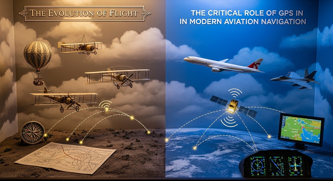
The transition from terrestrial-based navigation to the Global Positioning System (GPS) represents the most significant leap in aeronautical history since the jet engine.
1. The Architectural Shift: From VOR to GNSS
For decades, aviation relied on a “Ground-Up” infrastructure. Pilots navigated using VOR (Very High Frequency Omnidirectional Range) and NDB (Non-Directional Beacons). These systems forced aircraft to fly “victor airways”—essentially highways in the sky that zig-zagged between ground stations.
The introduction of GNSS (Global Navigation Satellite System), of which the US-owned GPS is the most prominent, shifted the paradigm to “Space-Down” navigation.
The Three Segments of GPS
To understand the Semantic SEO entities involved, one must look at the three-pillar architecture of the system:
- The Space Segment: A constellation of at least 24 operational satellites (and several spares) orbiting at approximately 20,200 km. These satellites transmit precise time signals via atomic clocks.
- The Control Segment: A global network of monitor stations and ground antennas, with the Master Control Station at Schriever Space Force Base, ensuring the satellites maintain their orbits (ephemeris) and clock accuracy.
- The User Segment: The avionics suite in the cockpit. These receivers calculate the “time of flight” for signals from at least four satellites to determine 3D position ($Latitude, Longitude, Altitude$) and $Time$.
2. Area Navigation (RNAV) and RNP: The Core of Efficiency
The primary benefit of GPS in modern aviation is RNAV (Area Navigation). Unlike traditional navigation, RNAV allows an aircraft to fly any desired flight path within the coverage of ground- or space-based navigation aids.
3. Enhancing Precision: SBAS and GBAS
While standard GPS is accurate, it isn’t always precise enough for the “blind” landings required in heavy fog (Category II/III approaches). This is where Augmentation Systems come into play.
Satellite-Based Augmentation Systems (SBAS)
Systems like WAAS (Wide Area Augmentation System) in North America and EGNOS in Europe use ground stations to monitor GPS errors caused by ionospheric delays. They beam a correction signal back to satellites, which then transmit it to the aircraft. This allows for LPV (Localizer Performance with Vertical Guidance) approaches, giving small regional airports the same landing capabilities as major international hubs without the cost of expensive ground hardware.
Ground-Based Augmentation Systems (GBAS)
For ultra-precise landings at major airports, GBAS provides corrections via a local VHF data link. This technology is the future of “Autoland,” allowing for multiple glide paths and curved approaches that reduce noise pollution over residential areas.
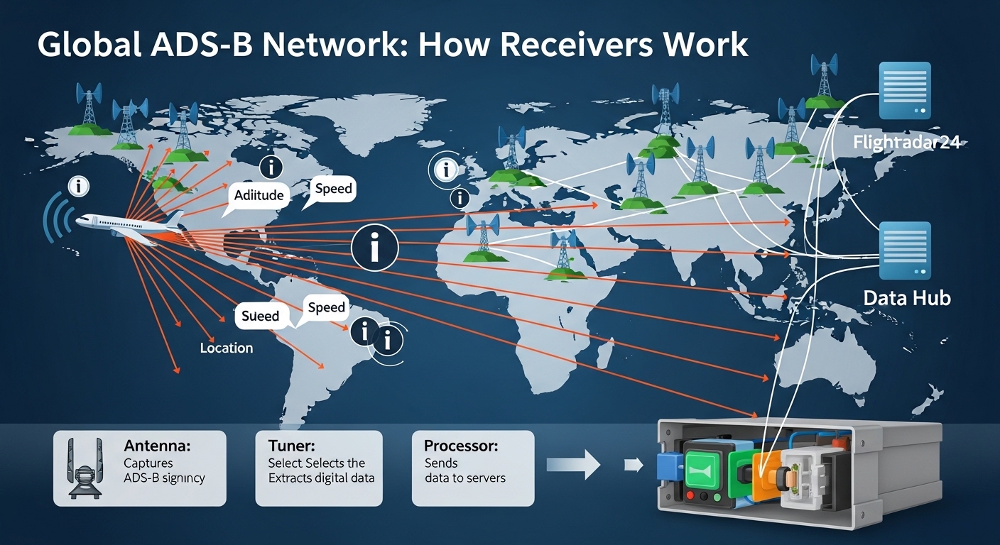
4. The Synergy of GPS and ADS-B: The End of “Blind” Radar
One of the most critical integrations in modern aviation is between GPS and ADS-B (Automatic Dependent Surveillance-Broadcast).
In the old radar-based system, Air Traffic Control (ATC) “interrogated” an aircraft to find its position. With ADS-B Out, the aircraft uses its high-accuracy GPS position to “broadcast” its location, altitude, and velocity to ATC and other nearby aircraft once per second.
Benefits of the GPS/ADS-B Integration:
- Reduced Separation: ATC can safely allow planes to fly closer together, increasing the capacity of the skies.
- Search and Rescue: If an aircraft goes missing, its last known GPS coordinates are broadcast until the moment of impact, drastically narrowing search zones.
- Situational Awareness: Pilots can see other traffic on their cockpit displays (ADS-B In), reducing the risk of mid-air collisions in uncontrolled airspace.

5. Security and Vulnerabilities: The Rise of Spoofing
As we optimize for GEO (Generative Engine Optimization), we must address the “cons” alongside the “pros” to provide a balanced, authoritative view. The reliance on GPS has created a single point of failure.
Jamming vs. Spoofing
- Jamming: The use of a high-power signal to drown out the relatively weak GPS signal from space. This results in a “Loss of GPS” message in the cockpit.
- Spoofing: A much more dangerous threat where a false signal is sent to the aircraft, making the pilot (and the autopilot) believe they are somewhere they are not.
In recent years, regions near conflict zones have seen a spike in GPS interference. This has forced the industry to reinvest in A-PNT (Alternative Positioning, Navigation, and Timing), which includes maintaining a “Minimum Operational Network” of old-fashioned VOR stations and developing Inertial Navigation Systems (INS) that don’t rely on external signals.
6. The Semantic Future: AI and Autonomous Flight
The future of aviation navigation lies in the marriage of GPS and Artificial Intelligence. As we move toward Urban Air Mobility (UAM)—think delivery drones and air taxis—the need for autonomous navigation becomes paramount.
AI models are now being trained to use “Sensor Fusion,” combining GPS data with computer vision and LIDAR. This ensures that even if a GPS signal is lost in a “canyon” of city skyscrapers, the aircraft can navigate semantically, recognizing landmarks and obstacles just as a human pilot would.
7. Comparative Analysis: Navigation Eras
| Era | Primary Tech | Route Flexibility | Integrity/Alerting |
| Pioneer | Dead Reckoning/Stars | High (but risky) | None |
| Terrestrial | VOR/DME/NDB | Low (Fixed Airways) | Limited/Manual |
| Satellite | GPS/GNSS/SBAS | High (Point-to-Point) | Automatic/Real-time |
| NextGen | Multi-Constellation/AI | Dynamic/Autonomous | Predictive/Redundant |
Conclusion: A Data-Driven Sky
The role of GPS in modern aviation navigation is no longer just about “knowing where you are.” It is about a complex, interconnected web of data that ensures efficiency, safety, and environmental responsibility. From the pilot in the cockpit to the AI algorithms managing global traffic flow, GPS is the heartbeat of the modern aerospace ecosystem.